
Thank you for supporting this site ❤️
Make a donation
Make a donation
Webb City topographic map
Click on the map to display elevation.
Thank you for supporting this site ❤️
Make a donation
Make a donation
About this map
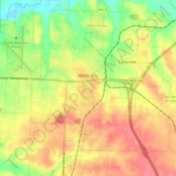
Name: Webb City topographic map, elevation, terrain.
Location: Webb City, Jasper County, Missouri, 64870, United States (37.10176 -94.49350 37.17494 -94.43851)
Average elevation: 304 m
Minimum elevation: 264 m
Maximum elevation: 334 m
Thank you for supporting this site ❤️
Make a donation
Make a donation
Other topographic maps
Click on a map to view its topography, its elevation and its terrain.