
Thank you for supporting this site ❤️
Make a donation
Make a donation
North Rim topographic map
Click on the map to display elevation.
Thank you for supporting this site ❤️
Make a donation
Make a donation
About this map
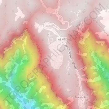
Name: North Rim topographic map, elevation, terrain.
Location: North Rim, Coconino County, Arizona, United States (36.20044 -112.07107 36.22044 -112.05107)
Average elevation: 2,297 m
Minimum elevation: 1,574 m
Maximum elevation: 2,556 m
Thank you for supporting this site ❤️
Make a donation
Make a donation
Other topographic maps
Click on a map to view its topography, its elevation and its terrain.
Grand Canyon Village
United States > Arizona > Coconino County > Grand Canyon Village
Average elevation: 1,666 m