
Lahnstein topographic map
Interactive map
Click on the map to display elevation.
About this map
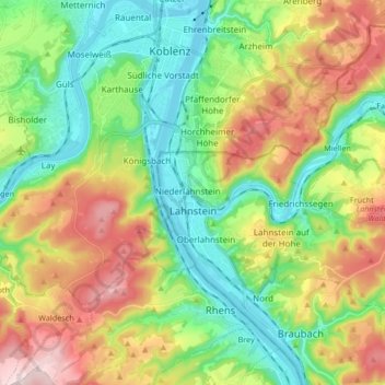
Name: Lahnstein topographic map, elevation, terrain.
Location: Lahnstein, Rhein-Lahn-Kreis, Rijnland-Palts, 56112, Duitsland (50.26751 7.58891 50.36035 7.75574)
Average elevation: 200 m
Minimum elevation: 62 m
Maximum elevation: 428 m