
Nalon topographic map
Interactive map
Click on the map to display elevation.
About this map
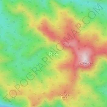
Name: Nalon topographic map, elevation, terrain.
Location: Nalon, Serbajadi, Aceh Timur, Atjeh, Indonesië (4.44880 97.40382 4.48880 97.44382)
Average elevation: 1,184 m
Minimum elevation: 912 m
Maximum elevation: 1,495 m