
Thank you for supporting this site ❤️
Make a donation
Make a donation
Saint-Denis topographic map
Click on the map to display elevation.
Thank you for supporting this site ❤️
Make a donation
Make a donation
About this map
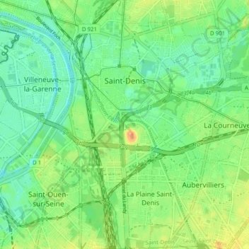
Name: Saint-Denis topographic map, elevation, terrain.
Location: Saint-Denis, Seine-Saint-Denis, Metropolitan France, France (48.90149 2.33322 48.95213 2.39812)
Average elevation: 38 m
Minimum elevation: 23 m
Maximum elevation: 61 m
Thank you for supporting this site ❤️
Make a donation
Make a donation
Other topographic maps
Click on a map to view its topography, its elevation and its terrain.
Pierrefitte-sur-Seine
France > Seine-Saint-Denis > Pierrefitte-sur-Seine > Pierrefitte-sur-Seine
Average elevation: 55 m