
Mato Grosso do Sul topographic map
Interactive map
Click on the map to display elevation.
About this map
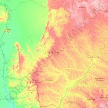
Name: Mato Grosso do Sul topographic map, elevation, terrain.
Location: Mato Grosso do Sul, Central-West Region, Brazil (-24.07336 -58.16969 -17.16745 -50.92300)
Average elevation: 349 m
Minimum elevation: 61 m
Maximum elevation: 1,208 m