
Shanid topographic map
Interactive map
Click on the map to display elevation.
About this map
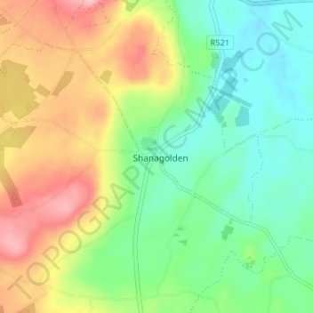
Name: Shanid topographic map, elevation, terrain.
Location: Shanid, Shanagolden, County Limerick, Munster, Ireland (52.55398 -9.12083 52.59398 -9.08083)
Average elevation: 64 m
Minimum elevation: 3 m
Maximum elevation: 159 m