
Mademühlen topographic map
Interactive map
Click on the map to display elevation.
About this map
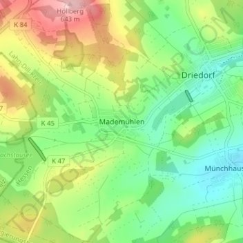
Name: Mademühlen topographic map, elevation, terrain.
Average elevation: 526 m
Minimum elevation: 453 m
Maximum elevation: 648 m
Other topographic maps
Click on a map to view its topography, its elevation and its terrain.
Münchhausen
Deutschland > Hessen > Lahn-Dill-Kreis > Driedorf
Münchhausen, Driedorf, Lahn-Dill-Kreis, Hessen, Deutschland
Average elevation: 498 m