
Thank you for supporting this site ❤️
Make a donation
Make a donation
Ban Bueng topographic map
Click on the map to display elevation.
Thank you for supporting this site ❤️
Make a donation
Make a donation
About this map
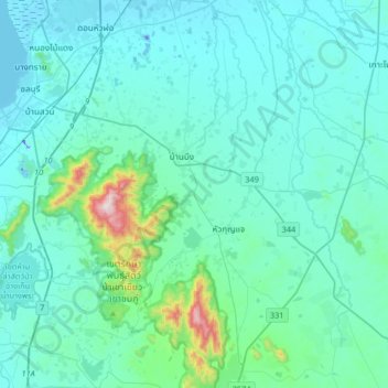
Name: Ban Bueng topographic map, elevation, terrain.
Location: Ban Bueng, Chon Buri Province, Thailand (13.11905 100.96623 13.43905 101.28623)
Average elevation: 82 m
Minimum elevation: -28 m
Maximum elevation: 779 m
Thank you for supporting this site ❤️
Make a donation
Make a donation
Other topographic maps
Click on a map to view its topography, its elevation and its terrain.