
Busoga topographic map
Interactive map
Click on the map to display elevation.
About this map
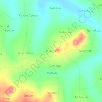
Name: Busoga topographic map, elevation, terrain.
Location: Busoga, Bugiri, Eastern Region, Ouganda (0.47197 33.62969 0.51197 33.66969)
Average elevation: 1,147 m
Minimum elevation: 1,107 m
Maximum elevation: 1,223 m