
Thank you for supporting this site ❤️
Make a donation
Make a donation
Khao Sok National Park topographic map
Click on the map to display elevation.
Thank you for supporting this site ❤️
Make a donation
Make a donation
About this map
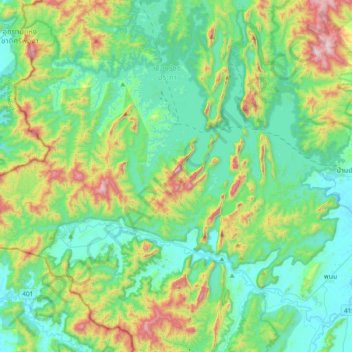
Name: Khao Sok National Park topographic map, elevation, terrain.
Location: Khao Sok National Park, Surat Thani Province, 84250, Thailand (8.82859 98.45265 9.10610 98.83247)
Average elevation: 254 m
Minimum elevation: 13 m
Maximum elevation: 1,001 m
Thank you for supporting this site ❤️
Make a donation
Make a donation
Other topographic maps
Click on a map to view its topography, its elevation and its terrain.