
Thank you for supporting this site ❤️
Make a donation
Make a donation
Sergelen topographic map
Click on the map to display elevation.
Thank you for supporting this site ❤️
Make a donation
Make a donation
About this map
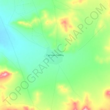
Name: Sergelen topographic map, elevation, terrain.
Location: Sergelen, Töv, Mongolia (47.57004 106.98168 47.65004 107.06168)
Average elevation: 1,483 m
Minimum elevation: 1,409 m
Maximum elevation: 1,636 m
Thank you for supporting this site ❤️
Make a donation
Make a donation