
Chausse Haut topographic map
Interactive map
Click on the map to display elevation.
About this map
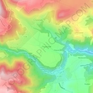
Name: Chausse Haut topographic map, elevation, terrain.
Average elevation: 759 m
Minimum elevation: 537 m
Maximum elevation: 1,010 m
Other topographic maps
Click on a map to view its topography, its elevation and its terrain.
Le Fromental
France > Auvergne-Rhône-Alpes > Puy-de-Dôme > Rentières
Le Fromental, Rentières, Issoire, Puy-de-Dôme, Auvergne-Rhône-Alpes, France métropolitaine, 63420, France
Average elevation: 733 m