
Thank you for supporting this site ❤️
Make a donation
Make a donation
Erlenbach topographic map
Click on the map to display elevation.
Thank you for supporting this site ❤️
Make a donation
Make a donation
Erlenbach
Die Statistisch-topographisch-historische Beschreibung des Großherzogthums Hessen berichtet 1829 über Erlenbach.
Thank you for supporting this site ❤️
Make a donation
Make a donation
About this map
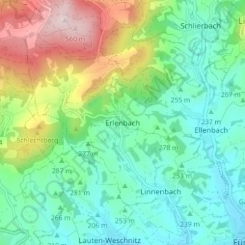
Name: Erlenbach topographic map, elevation, terrain.
Location: Erlenbach, Fürth, Kreis Bergstraße, Hessen, 64678, Deutschland (49.64730 8.72556 49.68730 8.76556)
Average elevation: 308 m
Minimum elevation: 190 m
Maximum elevation: 582 m
Thank you for supporting this site ❤️
Make a donation
Make a donation