
灵丘县 topographic map
Interactive map
Click on the map to display elevation.
About this map
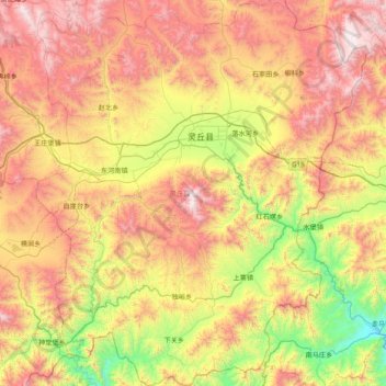
Name: 灵丘县 topographic map, elevation, terrain.
Location: 灵丘县, 大同市, 山西省, 中国 (39.04845 113.89149 39.65214 114.56551)
Average elevation: 1,250 m
Minimum elevation: 465 m
Maximum elevation: 2,198 m
Other topographic maps
Click on a map to view its topography, its elevation and its terrain.