
Thank you for supporting this site ❤️
Make a donation
Make a donation
Teufelstisch topographic map
Click on the map to display elevation.
Thank you for supporting this site ❤️
Make a donation
Make a donation
Teufelstisch
Der Teufelstisch (901 m) ist eine sagenumwobene Felsformation in der Nähe von Bischofsmais im mittleren Bayerischen Wald und ein stark frequentiertes Wanderziel. Er bildet einen eigenen kleinen Höhenzug mit beachtlichen Felsen entlang der Grathöhe.
Thank you for supporting this site ❤️
Make a donation
Make a donation
About this map
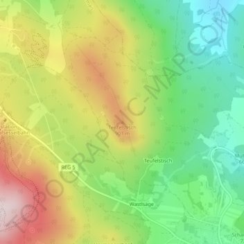
Name: Teufelstisch topographic map, elevation, terrain.
Average elevation: 766 m
Minimum elevation: 580 m
Maximum elevation: 1,010 m
Thank you for supporting this site ❤️
Make a donation
Make a donation