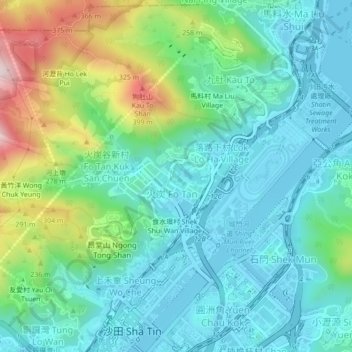
拔子窩 Pat Tsz Wo topographic map
Interactive map
Click on the map to display elevation.
About this map
Name: 拔子窩 Pat Tsz Wo topographic map, elevation, terrain.
Average elevation: 116 m
Minimum elevation: -4 m
Maximum elevation: 460 m

Click on the map to display elevation.
Name: 拔子窩 Pat Tsz Wo topographic map, elevation, terrain.
Average elevation: 116 m
Minimum elevation: -4 m
Maximum elevation: 460 m