
Thank you for supporting this site ❤️
Make a donation
Make a donation
Martinsthal topographic map
Click on the map to display elevation.
Thank you for supporting this site ❤️
Make a donation
Make a donation
About this map
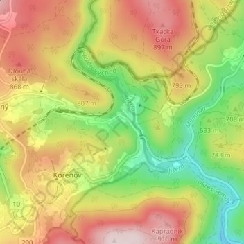
Name: Martinsthal topographic map, elevation, terrain.
Average elevation: 743 m
Minimum elevation: 545 m
Maximum elevation: 946 m
Thank you for supporting this site ❤️
Make a donation
Make a donation
Other topographic maps
Click on a map to view its topography, its elevation and its terrain.
národní přírodní rezervace Rašeliniště Jizerky
Tschechien > Nordosten > Reichenberger Region > Bad Wurzelsdorf > Klein Iser
Average elevation: 906 m