
Thank you for supporting this site ❤️
Make a donation
Make a donation
Passo Zovo topographic map
Click on the map to display elevation.
Thank you for supporting this site ❤️
Make a donation
Make a donation
About this map
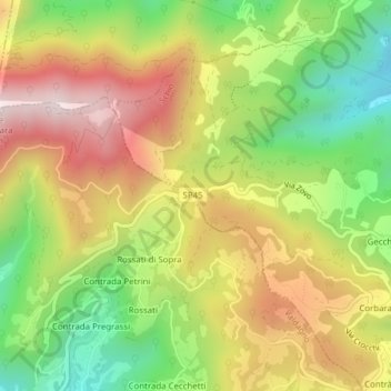
Name: Passo Zovo topographic map, elevation, terrain.
Location: Passo Zovo, Schio, Vicenza, Veneto, 36015, Italia (45.68392 11.30971 45.68402 11.30981)
Average elevation: 580 m
Minimum elevation: 264 m
Maximum elevation: 908 m
Thank you for supporting this site ❤️
Make a donation
Make a donation
Other topographic maps
Click on a map to view its topography, its elevation and its terrain.