
砂河镇 topographic map
Interactive map
Click on the map to display elevation.
About this map
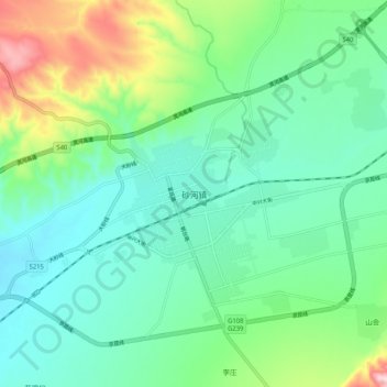
Name: 砂河镇 topographic map, elevation, terrain.
Location: 砂河镇, 繁峙县, Xinzhou, Shanxi, Chine (39.22659 113.51706 39.30659 113.59706)
Average elevation: 1,138 m
Minimum elevation: 1,045 m
Maximum elevation: 1,404 m