
Thank you for supporting this site ❤️
Make a donation
Make a donation
Tabor Hill topographic map
Click on the map to display elevation.
Thank you for supporting this site ❤️
Make a donation
Make a donation
About this map
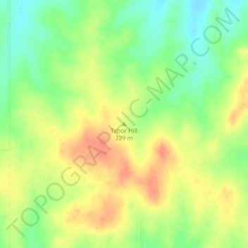
Name: Tabor Hill topographic map, elevation, terrain.
Location: Tabor Hill, Wabaunsee County, Kansas, United States (39.11217 -96.07893 39.11227 -96.07883)
Average elevation: 325 m
Minimum elevation: 299 m
Maximum elevation: 348 m
Thank you for supporting this site ❤️
Make a donation
Make a donation
Other topographic maps
Click on a map to view its topography, its elevation and its terrain.
Maple Hill
United States > Kansas > Wabaunsee County
Maple Hill was founded about 1882. It was named from a grove of maple trees growing upon an elevation.
Average elevation: 298 m
Maple Hill
United States > Kansas > Wabaunsee County
Maple Hill was founded about 1882. It was named from a grove of maple trees growing upon an elevation.
Average elevation: 298 m