
Hindhede Quarry topographic map
Click on the map to display elevation.
About this map
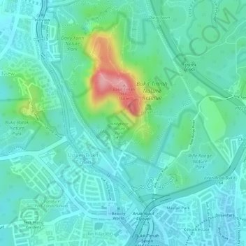
Name: Hindhede Quarry topographic map, elevation, terrain.
Location: Hindhede Quarry, Bukit Panjang, Northwest, Singapore (1.34938 103.77486 1.35164 103.77764)
Average elevation: 50 m
Minimum elevation: 15 m
Maximum elevation: 168 m
Other topographic maps
Click on a map to view its topography, its elevation and its terrain.