
Canewdon topographic map
Click on the map to display elevation.
About this map
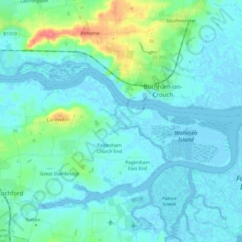
Name: Canewdon topographic map, elevation, terrain.
Average elevation: 9 m
Minimum elevation: -5 m
Maximum elevation: 55 m
Other topographic maps
Click on a map to view its topography, its elevation and its terrain.
Wallasea Island
United Kingdom > England > Essex > Rochford > Paglesham Church End
Average elevation: 1 m