
Alost topographic map
Interactive map
Click on the map to display elevation.
About this map
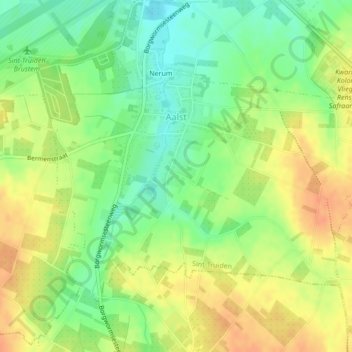
Name: Alost topographic map, elevation, terrain.
Location: Alost, Saint-Trond, Hasselt, Limbourg, Flandre, Belgique (50.76719 5.19743 50.78648 5.23765)
Average elevation: 81 m
Minimum elevation: 61 m
Maximum elevation: 99 m