
Thank you for supporting this site ❤️
Make a donation
Make a donation
Province of Virú topographic map
Click on the map to display elevation.
Thank you for supporting this site ❤️
Make a donation
Make a donation
About this map
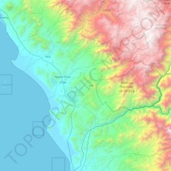
Name: Province of Virú topographic map, elevation, terrain.
Location: Province of Virú, La Libertad, Peru (-8.97089 -78.93880 -8.14070 -78.23558)
Average elevation: 1,120 m
Minimum elevation: -1 m
Maximum elevation: 4,357 m
Thank you for supporting this site ❤️
Make a donation
Make a donation
Other topographic maps
Click on a map to view its topography, its elevation and its terrain.