
Thank you for supporting this site ❤️
Make a donation
Make a donation
Dalhem topographic map
Click on the map to display elevation.
Thank you for supporting this site ❤️
Make a donation
Make a donation
About this map
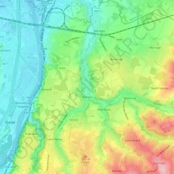
Name: Dalhem topographic map, elevation, terrain.
Location: Dalhem, Lüttich, Wallonien, 4607, Belgien (50.68090 5.70148 50.75547 5.81876)
Average elevation: 116 m
Minimum elevation: 50 m
Maximum elevation: 244 m
Thank you for supporting this site ❤️
Make a donation
Make a donation
Other topographic maps
Click on a map to view its topography, its elevation and its terrain.