
Cadrete topographic map
Interactive map
Click on the map to display elevation.
About this map
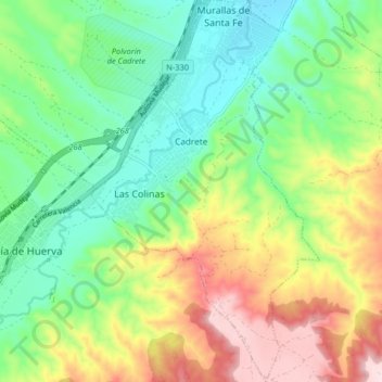
Name: Cadrete topographic map, elevation, terrain.
Location: Cadrete, Zaragoza, Aragón, 50420, España (41.51722 -0.98247 41.57819 -0.93386)
Average elevation: 404 m
Minimum elevation: 279 m
Maximum elevation: 619 m