
Thank you for supporting this site ❤️
Make a donation
Make a donation
Takeley topographic map
Click on the map to display elevation.
Thank you for supporting this site ❤️
Make a donation
Make a donation
About this map
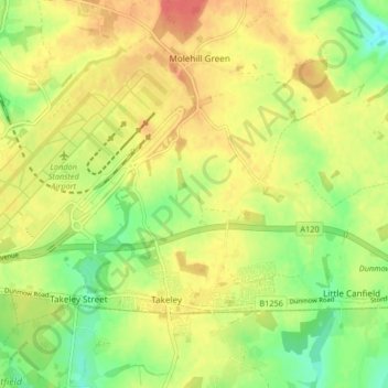
Name: Takeley topographic map, elevation, terrain.
Location: Takeley, Uttlesford, Essex, England, United Kingdom (51.86146 0.22185 51.90227 0.30413)
Average elevation: 98 m
Minimum elevation: 71 m
Maximum elevation: 121 m
Thank you for supporting this site ❤️
Make a donation
Make a donation
Other topographic maps
Click on a map to view its topography, its elevation and its terrain.