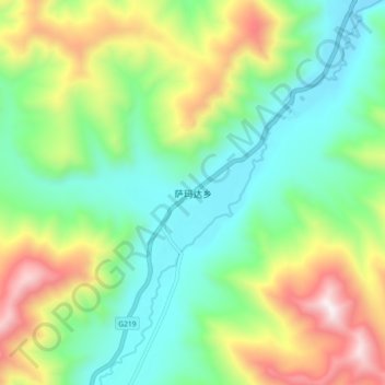
萨玛达乡 topographic map
Interactive map
Click on the map to display elevation.
About this map
Name: 萨玛达乡 topographic map, elevation, terrain.
Average elevation: 4,733 m
Minimum elevation: 4,351 m
Maximum elevation: 5,489 m

Click on the map to display elevation.
Name: 萨玛达乡 topographic map, elevation, terrain.
Average elevation: 4,733 m
Minimum elevation: 4,351 m
Maximum elevation: 5,489 m