
Ngounié topographic map
Interactive map
Click on the map to display elevation.
About this map
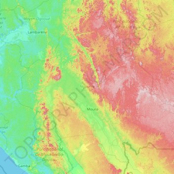
Name: Ngounié topographic map, elevation, terrain.
Location: Ngounié, Gabun (-2.68504 9.88203 -0.37611 12.51691)
Average elevation: 281 m
Minimum elevation: 0 m
Maximum elevation: 981 m
Other topographic maps
Click on a map to view its topography, its elevation and its terrain.