
Johnston Island topographic map
Interactive map
Click on the map to display elevation.
About this map
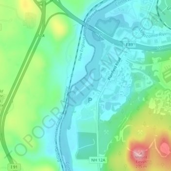
Name: Johnston Island topographic map, elevation, terrain.
Location: Johnston Island, Lebanon, Grafton County, New Hampshire, USA (43.62311 -72.33225 43.62719 -72.32768)
Average elevation: 145 m
Minimum elevation: 94 m
Maximum elevation: 285 m