
重庆茶山竹海国家森林公园 topographic map
Interactive map
Click on the map to display elevation.
About this map
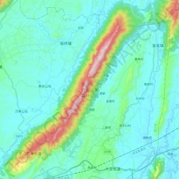
Name: 重庆茶山竹海国家森林公园 topographic map, elevation, terrain.
Location: 重庆茶山竹海国家森林公园, 茶山竹海街道, 永川区, 重庆市, 中国 (29.37291 105.87440 29.55578 106.04932)
Average elevation: 386 m
Minimum elevation: 264 m
Maximum elevation: 993 m