
Tanah Grogot topographic map
Interactive map
Click on the map to display elevation.
About this map
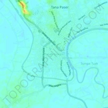
Name: Tanah Grogot topographic map, elevation, terrain.
Location: Tanah Grogot, Paser, East Kalimantan, 76521, Indonesia (-1.93492 116.17507 -1.89492 116.21507)
Average elevation: 5 m
Minimum elevation: 1 m
Maximum elevation: 25 m
Other topographic maps
Click on a map to view its topography, its elevation and its terrain.
Tajur
Indonesia > East Kalimantan > Paser
Tajur, Paser, East Kalimantan, Kalimantan, Indonesia
Average elevation: 13 m
Krayan Jaya
Indonesia > East Kalimantan > Paser
Krayan Jaya, Paser, East Kalimantan, Indonesia
Average elevation: 18 m