
Thank you for supporting this site ❤️
Make a donation
Make a donation
Chalk Mountain topographic map
Click on the map to display elevation.
Thank you for supporting this site ❤️
Make a donation
Make a donation
About this map
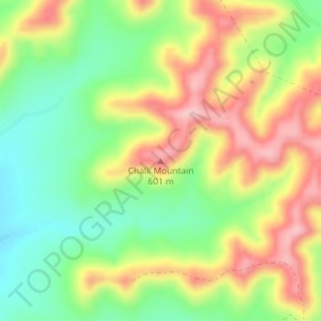
Name: Chalk Mountain topographic map, elevation, terrain.
Location: Chalk Mountain, Bandera County, Texas, United States (29.69267 -99.24509 29.69277 -99.24499)
Average elevation: 517 m
Minimum elevation: 436 m
Maximum elevation: 610 m
Thank you for supporting this site ❤️
Make a donation
Make a donation
Other topographic maps
Click on a map to view its topography, its elevation and its terrain.