
Thank you for supporting this site ❤️
Make a donation
Make a donation
Chana topographic map
Click on the map to display elevation.
Thank you for supporting this site ❤️
Make a donation
Make a donation
About this map
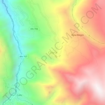
Name: Chana topographic map, elevation, terrain.
Location: Chana, San Pedro de Chaná, Huari, Áncash, Perú (-9.42328 -77.03126 -9.38328 -76.99126)
Average elevation: 3,445 m
Minimum elevation: 2,721 m
Maximum elevation: 4,183 m
Thank you for supporting this site ❤️
Make a donation
Make a donation