
San Gregorio topographic map
Interactive map
Click on the map to display elevation.
About this map
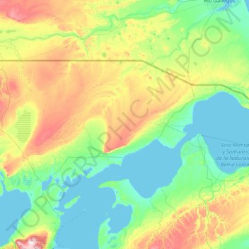
Name: San Gregorio topographic map, elevation, terrain.
Average elevation: 115 m
Minimum elevation: 0 m
Maximum elevation: 620 m
Other topographic maps
Click on a map to view its topography, its elevation and its terrain.
Punta Arenas
Chile > Region von Magellan und der chilenischen Antarktis > Provincia de Magallanes
Punta Arenas, Provincia de Magallanes, Region von Magellan und der chilenischen Antarktis, Chile
Average elevation: 187 m