
Thank you for supporting this site ❤️
Make a donation
Make a donation
Breitenlesau topographic map
Click on the map to display elevation.
Thank you for supporting this site ❤️
Make a donation
Make a donation
Breitenlesau
Das Kirchdorf Breitenlesau befindet sich etwa viereinhalb Kilometer nordwestlich von Waischenfeld und liegt auf einer Höhe von 457 Metern.
Thank you for supporting this site ❤️
Make a donation
Make a donation
About this map
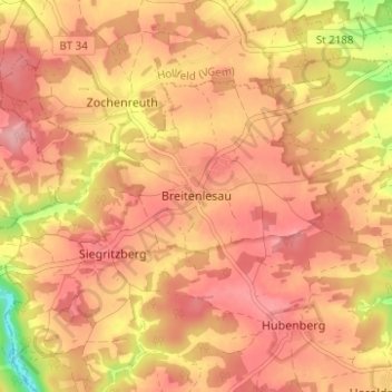
Name: Breitenlesau topographic map, elevation, terrain.
Average elevation: 445 m
Minimum elevation: 361 m
Maximum elevation: 483 m
Thank you for supporting this site ❤️
Make a donation
Make a donation
Other topographic maps
Click on a map to view its topography, its elevation and its terrain.