
长胜东街道 topographic map
Interactive map
Click on the map to display elevation.
About this map
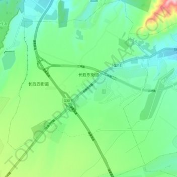
Name: 长胜东街道 topographic map, elevation, terrain.
Location: 长胜东街道, 沙依巴克区, 乌鲁木齐市, 新疆维吾尔自治区, 830000, 中国 (43.69451 87.47312 43.76321 87.53472)
Average elevation: 1,106 m
Minimum elevation: 1,005 m
Maximum elevation: 1,382 m
Other topographic maps
Click on a map to view its topography, its elevation and its terrain.