
Thank you for supporting this site ❤️
Make a donation
Make a donation
Udall topographic map
Click on the map to display elevation.
Thank you for supporting this site ❤️
Make a donation
Make a donation
About this map
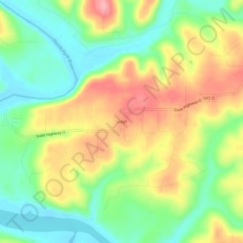
Name: Udall topographic map, elevation, terrain.
Location: Udall, Ozark County, Missouri, 65766, United States (36.52395 -92.27877 36.56395 -92.23877)
Average elevation: 217 m
Minimum elevation: 164 m
Maximum elevation: 283 m
Thank you for supporting this site ❤️
Make a donation
Make a donation