
Santa Pau topographic map
Interactive map
Click on the map to display elevation.
About this map
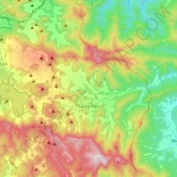
Name: Santa Pau topographic map, elevation, terrain.
Location: Santa Pau, Garrotxa, Gerunda, Catalunha, 17811, Espanha (42.11366 2.49372 42.19442 2.62966)
Average elevation: 545 m
Minimum elevation: 213 m
Maximum elevation: 1,004 m