
Rama topographic map
Interactive map
Click on the map to display elevation.
About this map
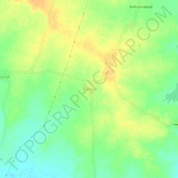
Name: Rama topographic map, elevation, terrain.
Location: Rama, Nagpur Rural Taluka, Nagpur, Maharashtra, India (20.81541 78.98505 20.85541 79.02505)
Average elevation: 260 m
Minimum elevation: 244 m
Maximum elevation: 274 m