
Elgin topographic map
Interactive map
Click on the map to display elevation.
About this map
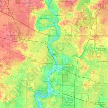
Name: Elgin topographic map, elevation, terrain.
Average elevation: 250 m
Minimum elevation: 209 m
Maximum elevation: 291 m
Other topographic maps
Click on a map to view its topography, its elevation and its terrain.
Elgin
États-Unis d'Amérique > Illinois > Kane County > Elgin
Elgin, Elgin Township, Kane County, Illinois, 60120, États-Unis d'Amérique
Average elevation: 255 m