
Thank you for supporting this site ❤️
Make a donation
Make a donation
STKRJ Rimba topographic map
Click on the map to display elevation.
Thank you for supporting this site ❤️
Make a donation
Make a donation
About this map
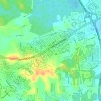
Name: STKRJ Rimba topographic map, elevation, terrain.
Location: STKRJ Rimba, Mukim Gadong A, Brunei-Muara District, Brunei (4.92891 114.89230 4.94054 114.90519)
Average elevation: 23 m
Minimum elevation: 7 m
Maximum elevation: 49 m
Thank you for supporting this site ❤️
Make a donation
Make a donation
Other topographic maps
Click on a map to view its topography, its elevation and its terrain.