
Thank you for supporting this site ❤️
Make a donation
Make a donation
Luang Namtha topographic map
Click on the map to display elevation.
Thank you for supporting this site ❤️
Make a donation
Make a donation
About this map
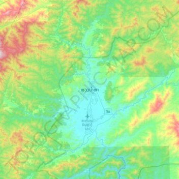
Name: Luang Namtha topographic map, elevation, terrain.
Location: Luang Namtha, Namtha District, Luang Namtha, Laos (20.84722 101.24764 21.16722 101.56764)
Average elevation: 847 m
Minimum elevation: 529 m
Maximum elevation: 1,722 m
Thank you for supporting this site ❤️
Make a donation
Make a donation