
Dungorkin topographic map
Interactive map
Click on the map to display elevation.
About this map
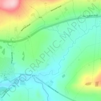
Name: Dungorkin topographic map, elevation, terrain.
Average elevation: 133 m
Minimum elevation: 68 m
Maximum elevation: 282 m
Other topographic maps
Click on a map to view its topography, its elevation and its terrain.
Dunady
Royaume-Uni > Irlande du Nord > Claudy
Dunady, Claudy, County Londonderry, Irlande du Nord, Royaume-Uni
Average elevation: 182 m
Claudy
Royaume-Uni > Irlande du Nord > Claudy
Claudy, County Londonderry, Irlande du Nord, BT47 4AA, Royaume-Uni
Average elevation: 126 m