
Thank you for supporting this site ❤️
Make a donation
Make a donation
Kienberg topographic map
Click on the map to display elevation.
Thank you for supporting this site ❤️
Make a donation
Make a donation
About this map
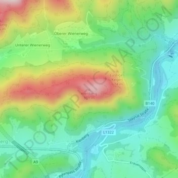
Name: Kienberg topographic map, elevation, terrain.
Average elevation: 546 m
Minimum elevation: 407 m
Maximum elevation: 799 m
Thank you for supporting this site ❤️
Make a donation
Make a donation
Other topographic maps
Click on a map to view its topography, its elevation and its terrain.
Freibad "Alpenbad" in Micheldorf
Österreich > Oberösterreich > Bezirk Kirchdorf > Micheldorf in Oberösterreich > Micheldorf > Atzelsdorf
Average elevation: 518 m