
Thank you for supporting this site ❤️
Make a donation
Make a donation
Tillman topographic map
Click on the map to display elevation.
Thank you for supporting this site ❤️
Make a donation
Make a donation
About this map
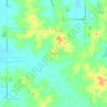
Name: Tillman topographic map, elevation, terrain.
Location: Tillman, Stoddard County, Missouri, United States (37.03533 -89.88426 37.07533 -89.84426)
Average elevation: 123 m
Minimum elevation: 108 m
Maximum elevation: 150 m
Thank you for supporting this site ❤️
Make a donation
Make a donation
Other topographic maps
Click on a map to view its topography, its elevation and its terrain.