
Thank you for supporting this site ❤️
Make a donation
Make a donation
Rohini Tehsil topographic map
Click on the map to display elevation.
Thank you for supporting this site ❤️
Make a donation
Make a donation
About this map
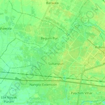
Name: Rohini Tehsil topographic map, elevation, terrain.
Location: Rohini Tehsil, North West Delhi, Delhi, India (28.68223 77.00119 28.73962 77.12274)
Average elevation: 216 m
Minimum elevation: 209 m
Maximum elevation: 221 m
Thank you for supporting this site ❤️
Make a donation
Make a donation