
Thank you for supporting this site ❤️
Make a donation
Make a donation
Naugaon topographic map
Click on the map to display elevation.
Thank you for supporting this site ❤️
Make a donation
Make a donation
About this map
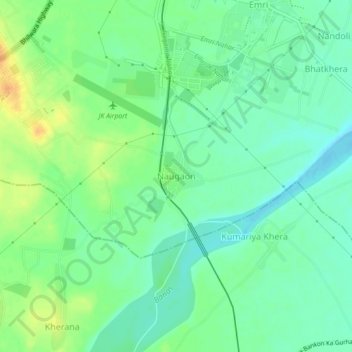
Name: Naugaon topographic map, elevation, terrain.
Location: Naugaon, Rajsamand Tehsil, Rajsamand, Rajasthan, 313300, India (24.99256 73.88648 25.03256 73.92648)
Average elevation: 535 m
Minimum elevation: 522 m
Maximum elevation: 554 m
Thank you for supporting this site ❤️
Make a donation
Make a donation