
Hauset topographic map
Interactive map
Click on the map to display elevation.
About this map
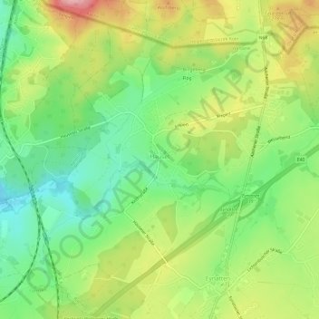
Name: Hauset topographic map, elevation, terrain.
Location: Hauset, Raeren, Verviers, Luik, Wallonië, 4730, België (50.69158 6.03748 50.72372 6.09715)
Average elevation: 267 m
Minimum elevation: 208 m
Maximum elevation: 347 m
Hauset ligt in het dal van de Geul op een hoogte van ongeveer 250 meter. De plaats wordt omringd door bossen, in het noorden vindt men uitlopers van het Aachener Wald. De Rotsiefbach stroomt vanuit een hoogte in dit bos zuidwaarts naar de Geul.